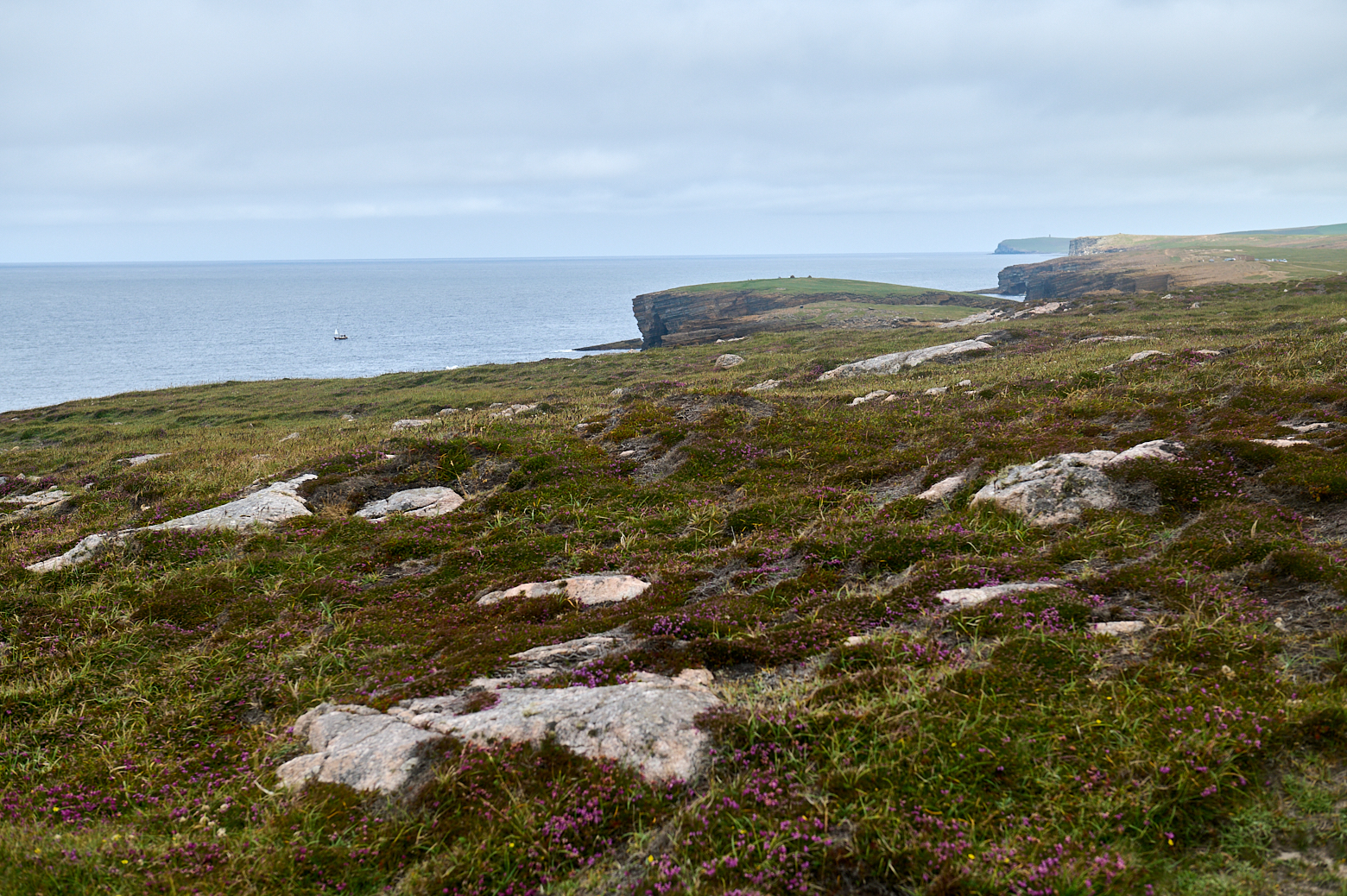
Wherever I looked, I always stumbled on this walk along the coast of Yesnaby – everyone seemed to say that one shouldn´t miss this one – of course, I had to go there!
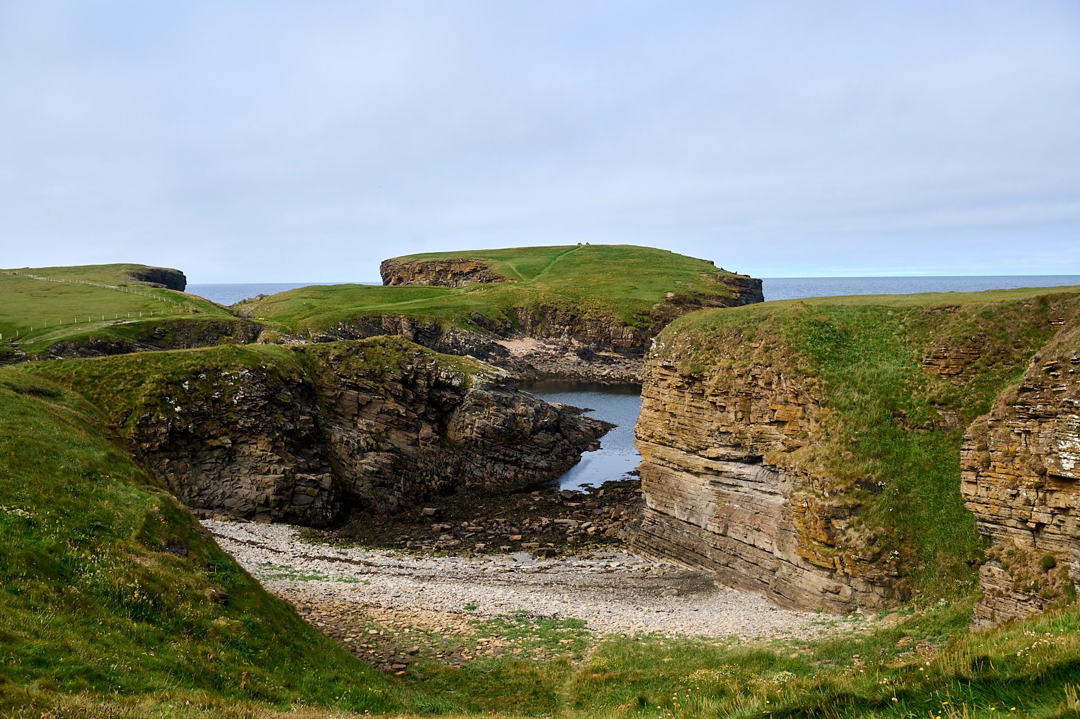
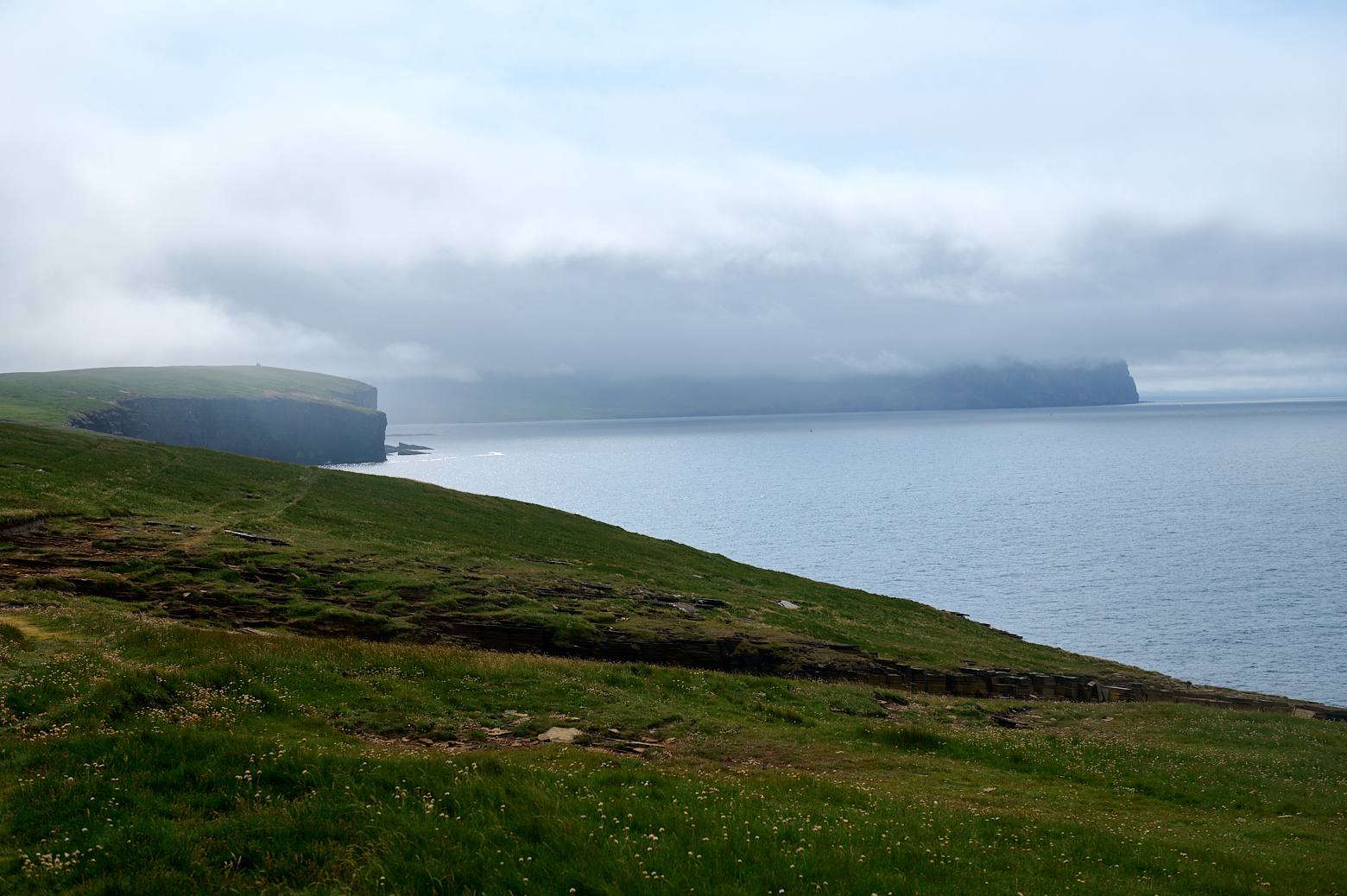
Yesnaby is located 6 miles from Stromness and it is a stretch of amazing cliffs, seastacks, rocky beaches and promontories carved out of Old Red Sandstone rocks which were part of the seabed 400 million years ago. (Northlinkferries.com)
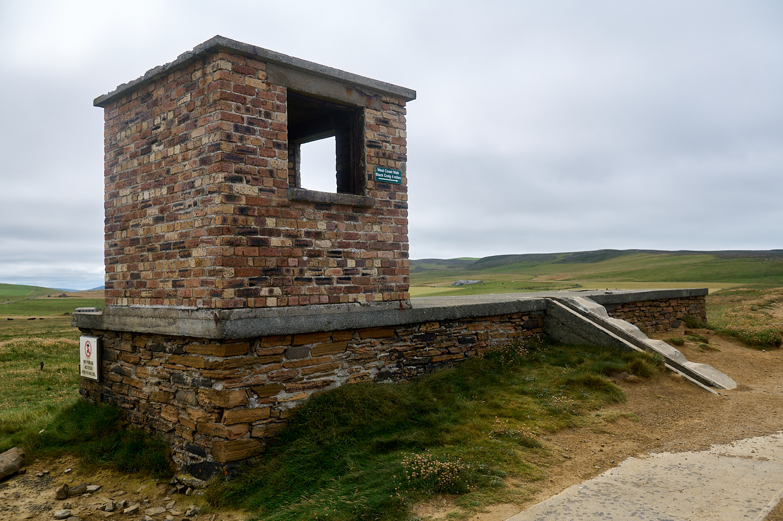
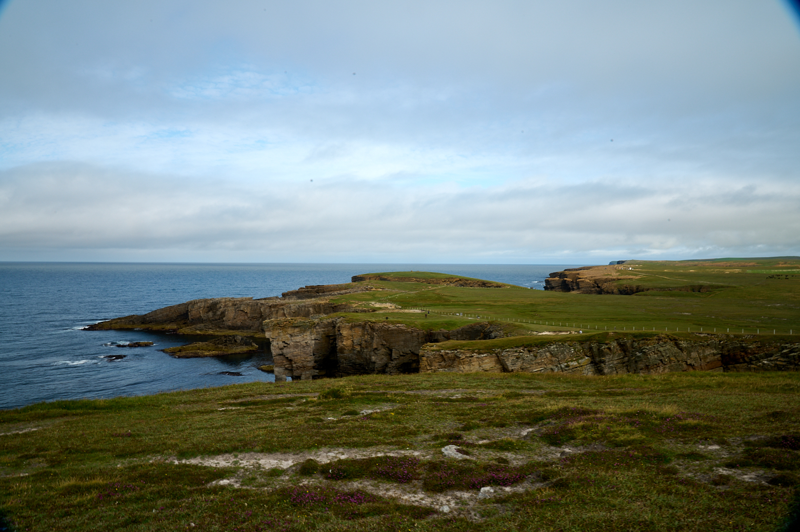
The coastal walk from Yesnaby (or Skaill) starts at some wartime buildings and one already gets a nice view of this rugged coastline, formed by the sea millions of years ago.
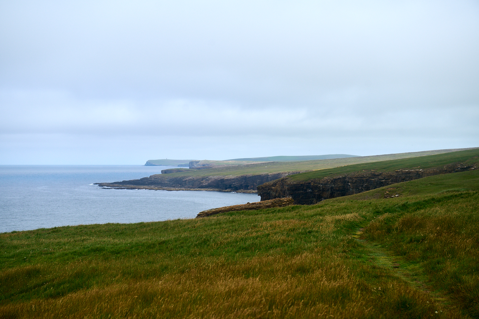
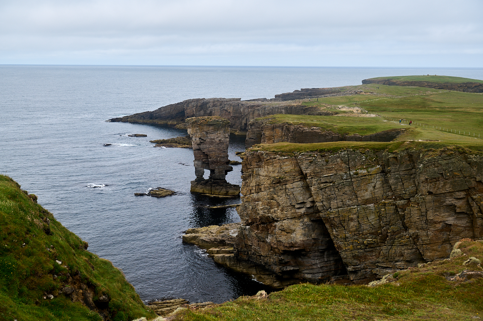
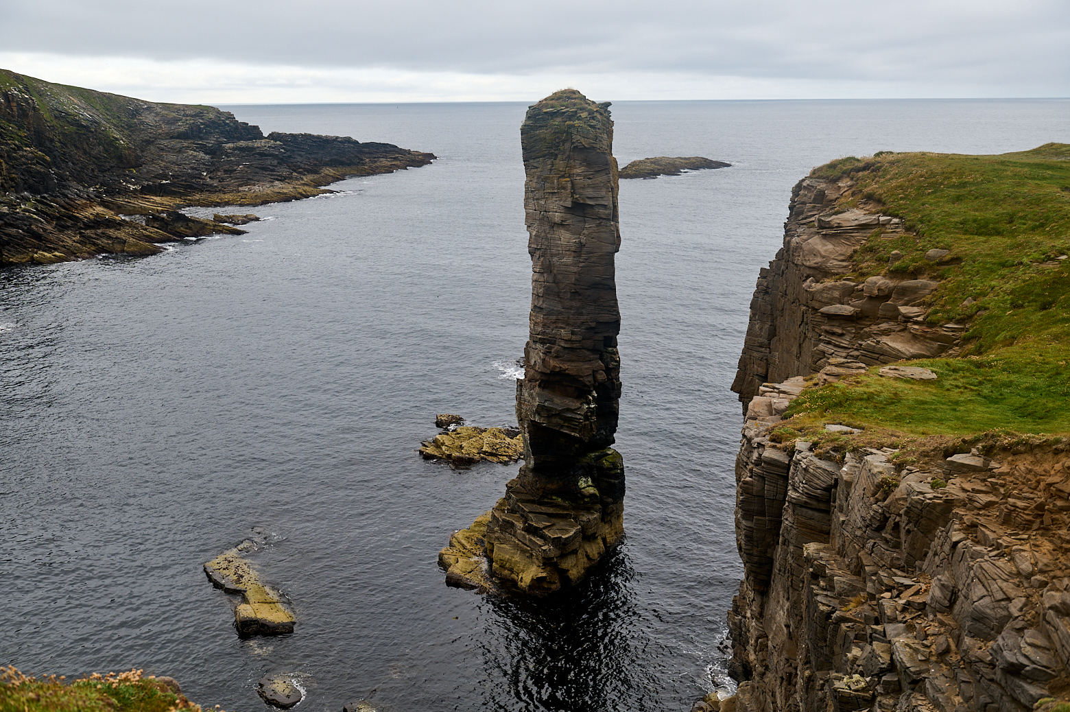
The result is a spectacular array of cliff scenery where you’ll find towering sea stacks and blow holes created by the force of the mighty ocean. (The Scotsman)
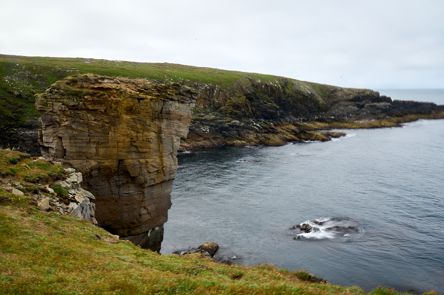
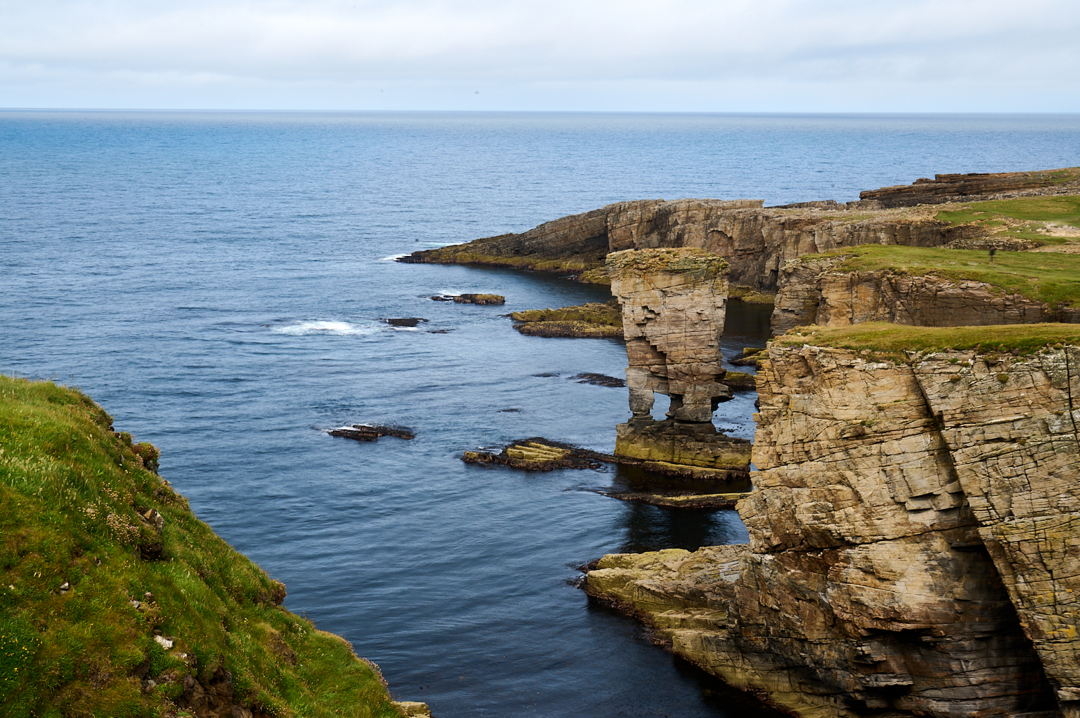
First view of Yesnaby Castle, a 35m high sea stack with two legs. And the first of a few stacks I saw this day, even without going the whole length to Stromness.
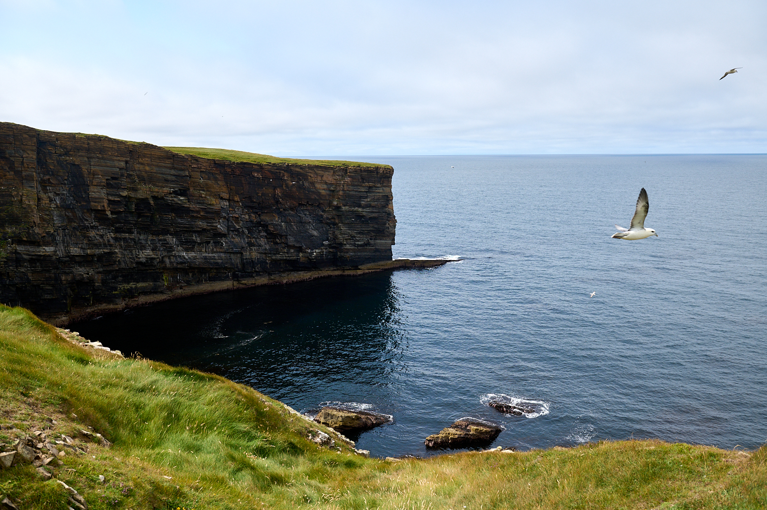
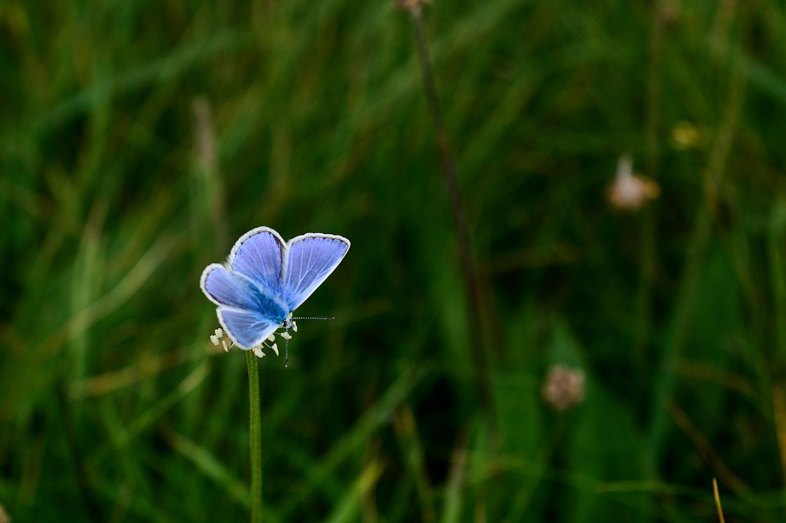
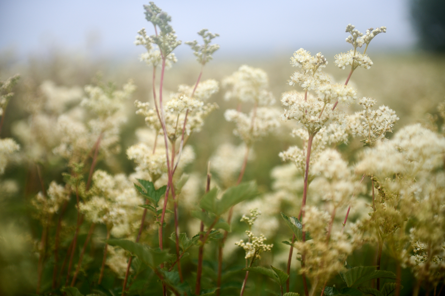
Nesting birds everywhere.
The island of Hoy under a cloud, I´ve never seen it without one, except on the day I left Orkney and the ferry was passing by Hoy.
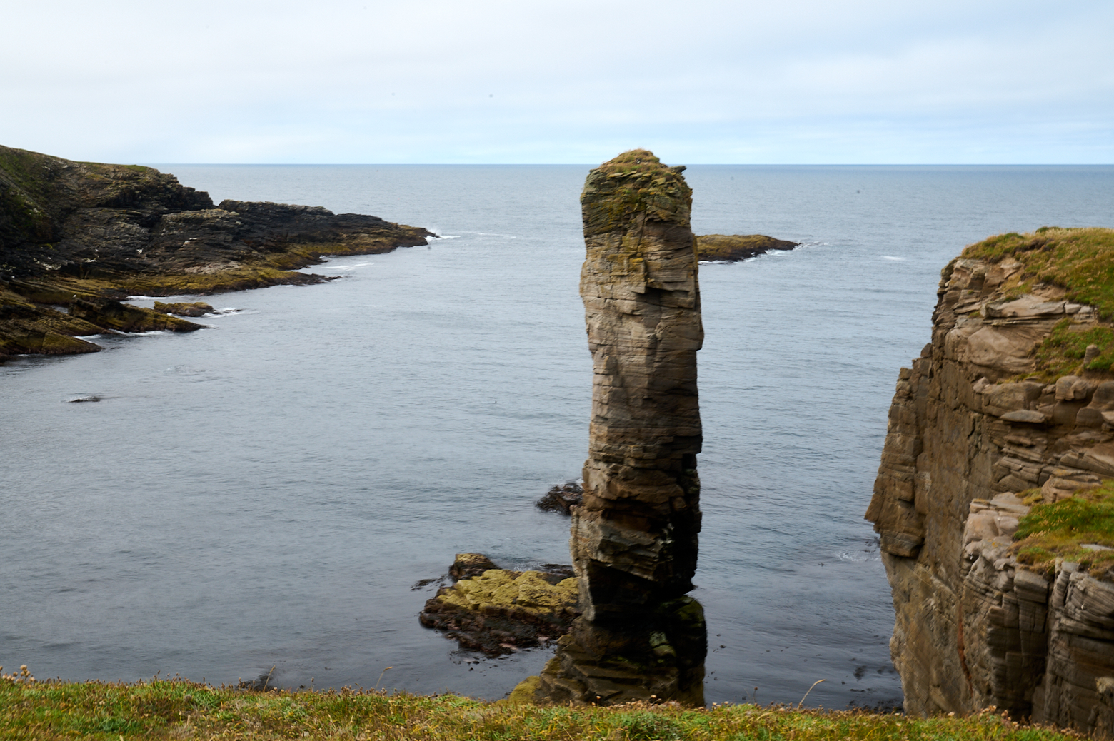
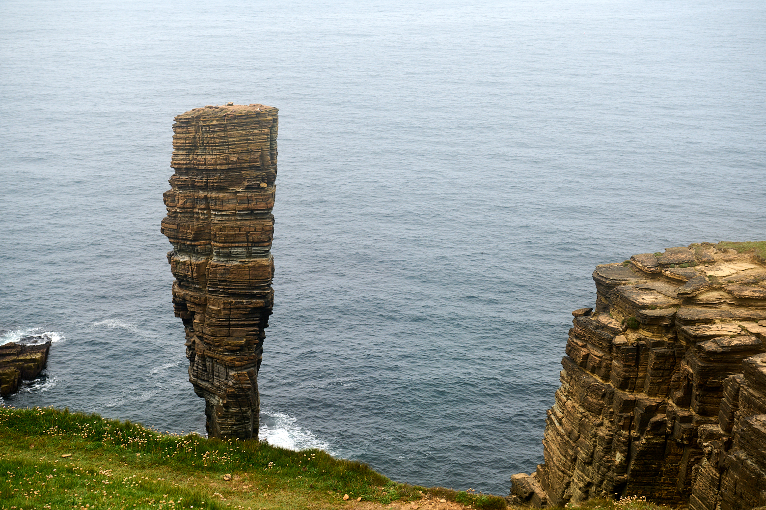
North Gaulton Castle, is another impressive stack about 70 m high.
I turned back after around 1,5 – 2 hours and walked back to Yesnaby.
One can also continue the walk on the other side of Yesnaby towards Skaill, I went for a bit but didn´t even make it to the Broch of Borwick – another time.
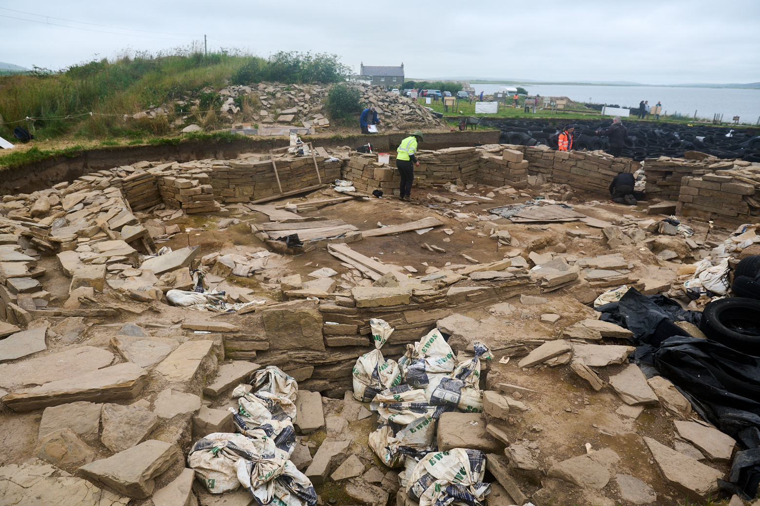
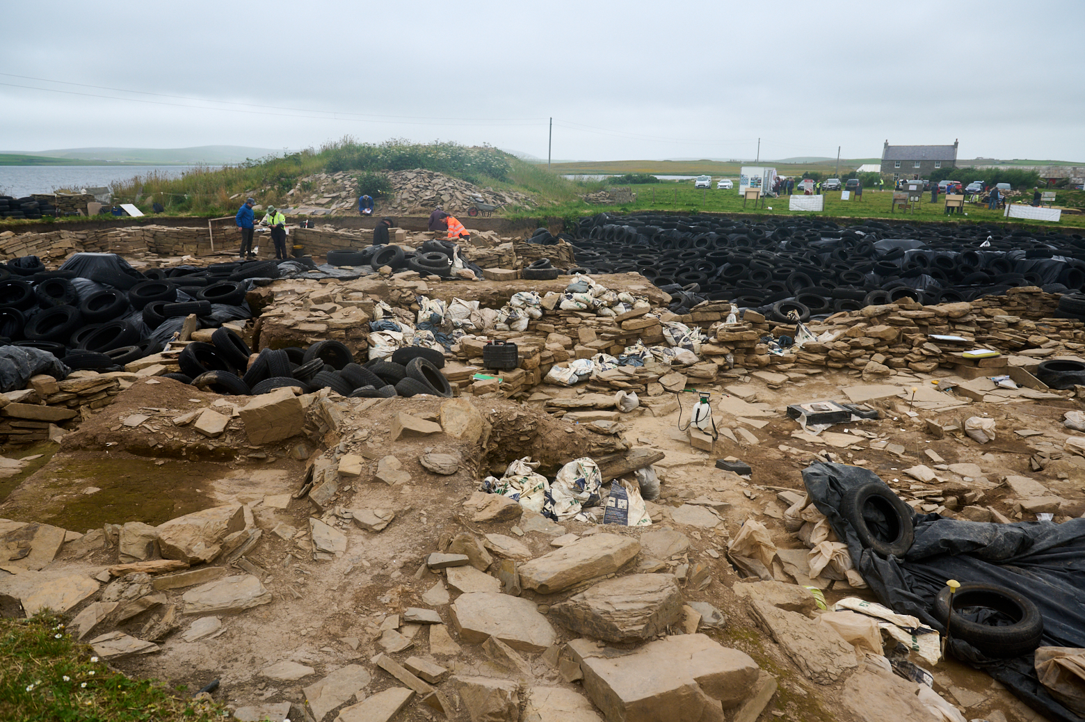
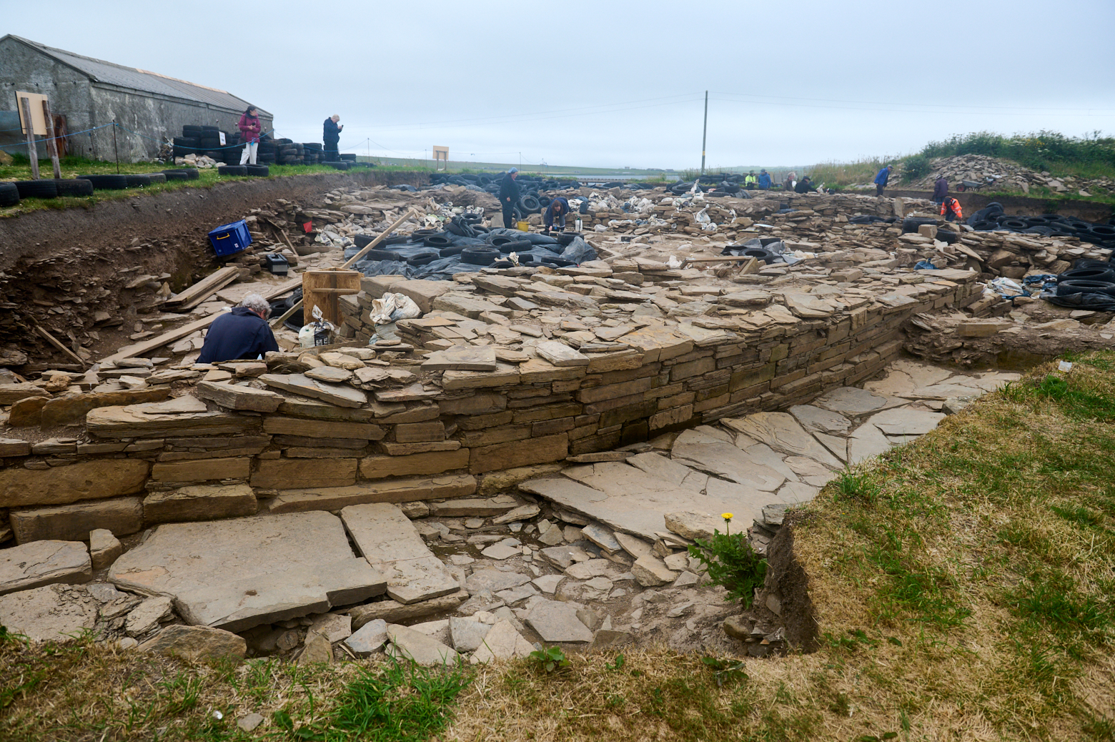
It´s been a dreich day when I came back to the Ness of Brodgar, again – but I still wanted to take a closer look at the ongoing excavations of the Ness.
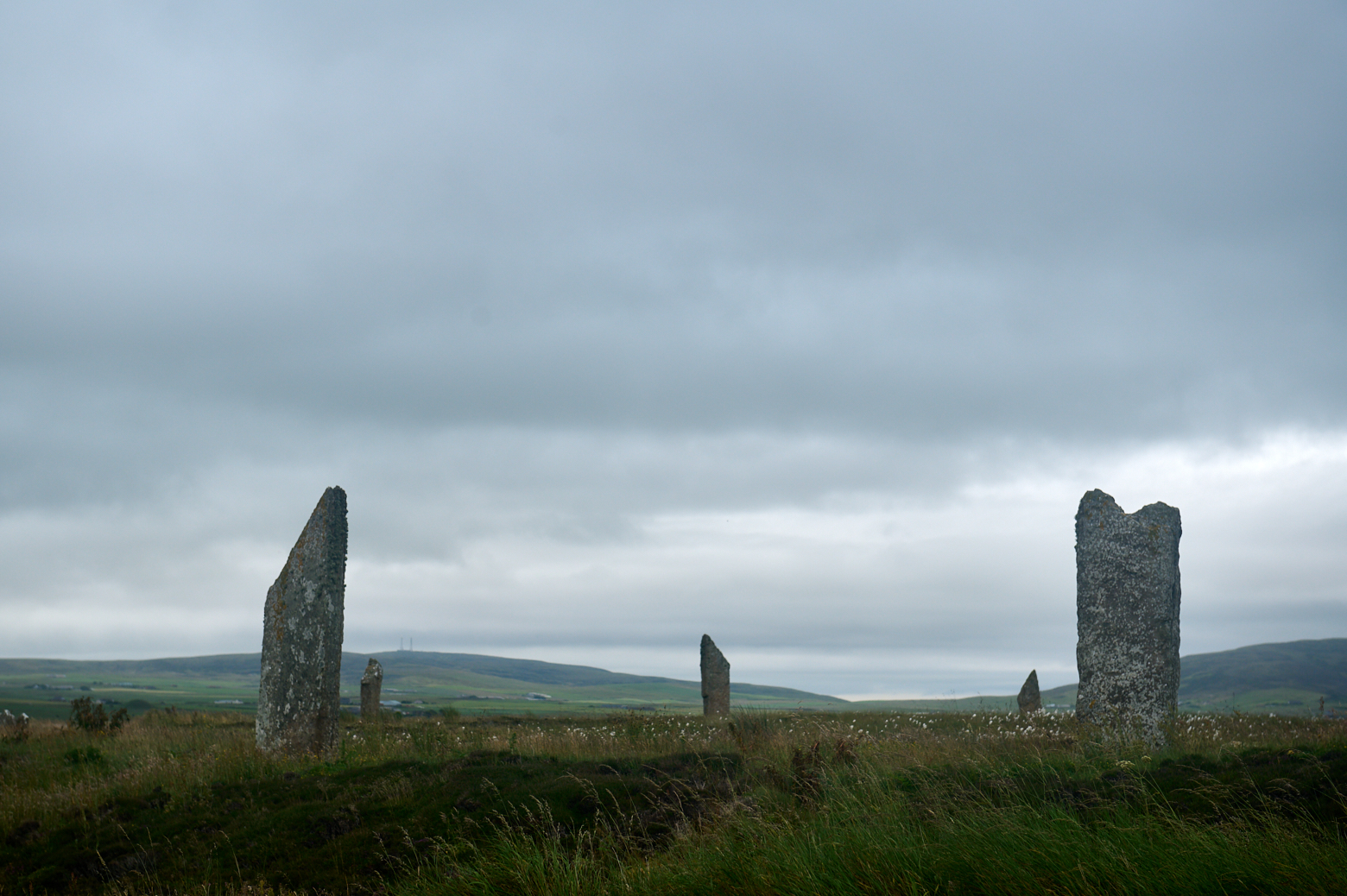
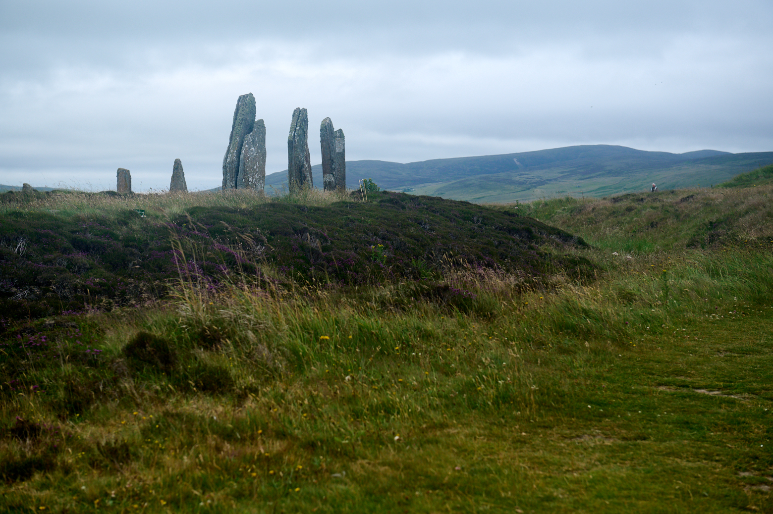
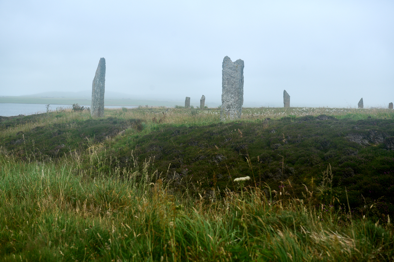
Ring of Brodgar
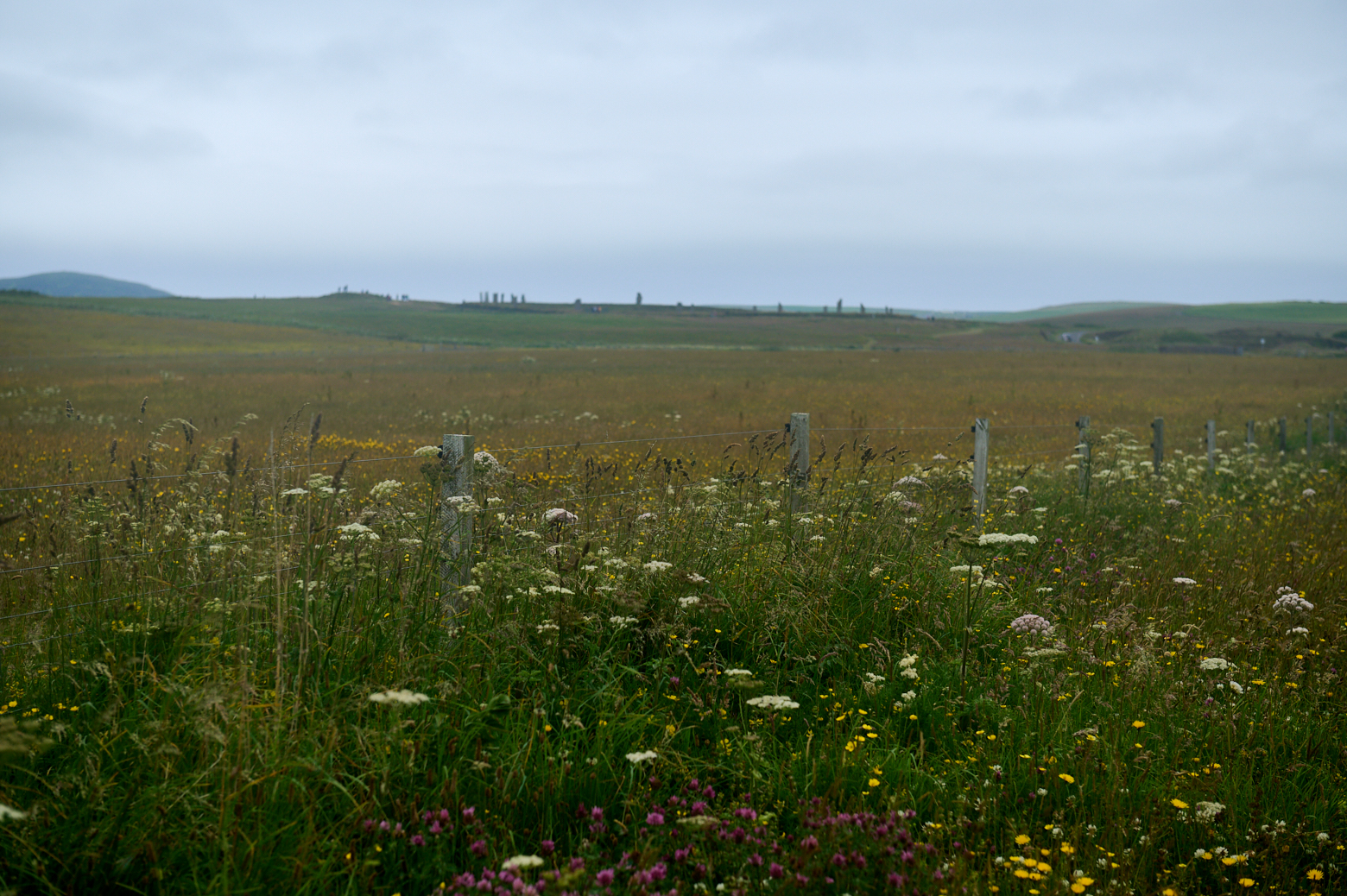
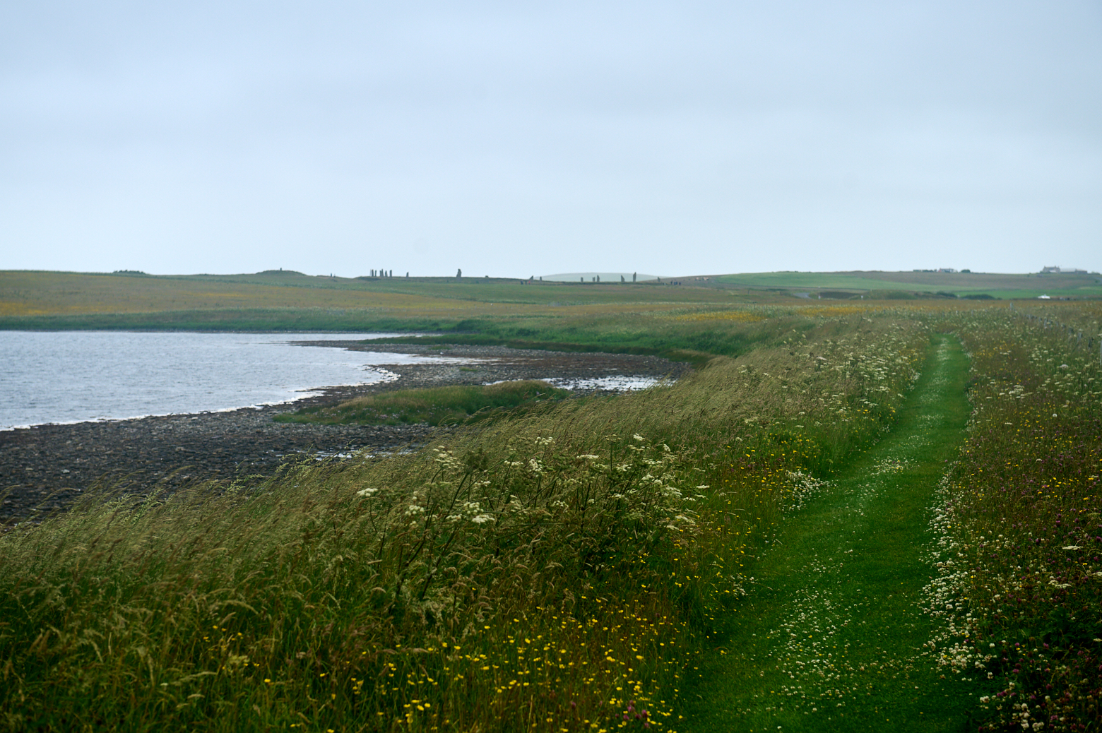
I parked the car at the Ring of Brodgar and started my walk along the Ness from there, how different it felt from the sunshine last time.
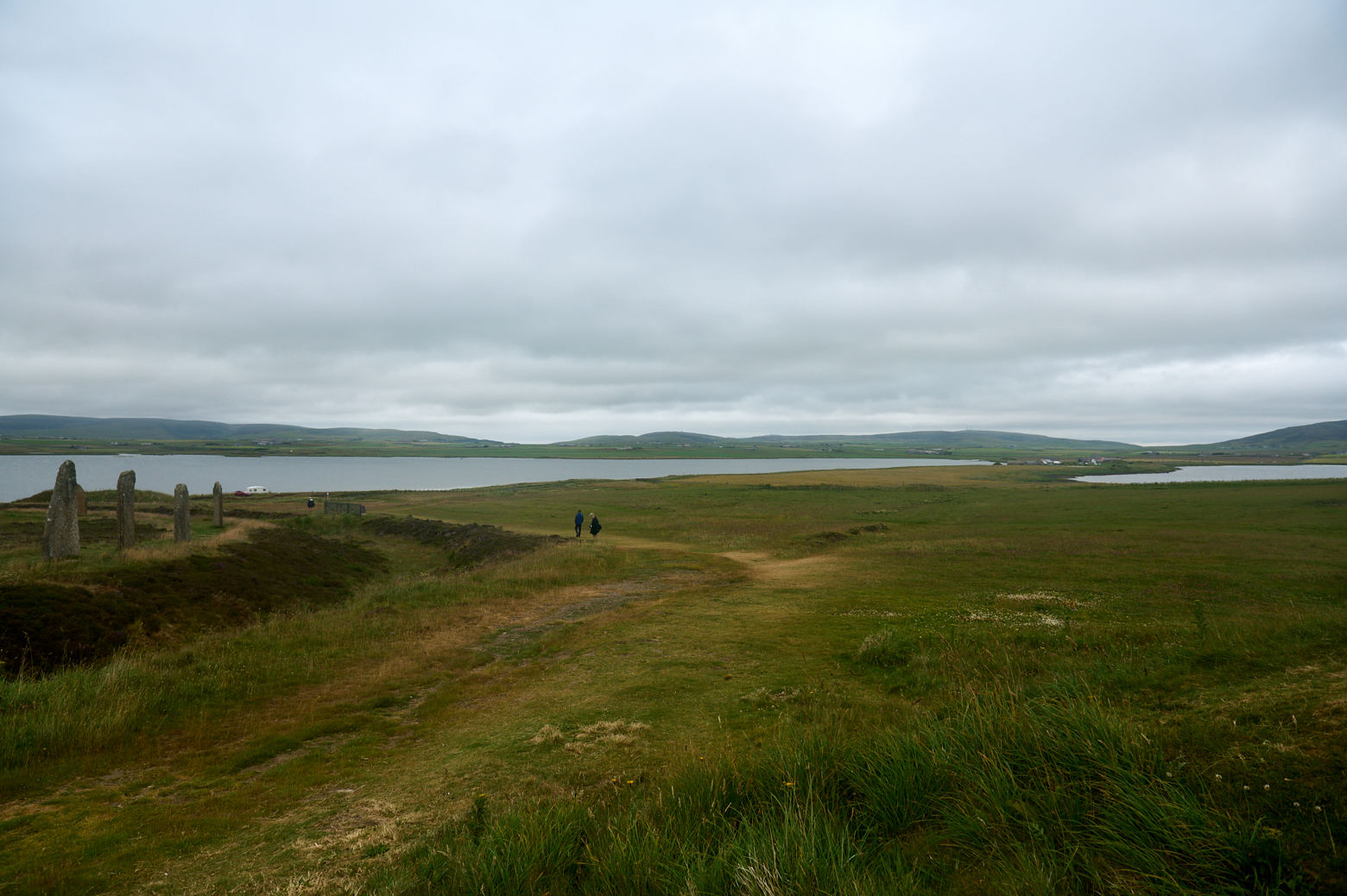
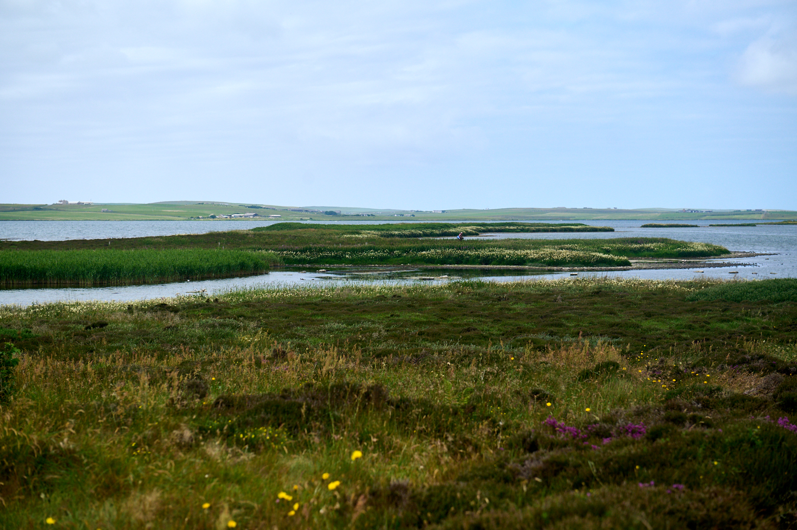
Path and view towards the Ness – it is just a short walk between the two lochs to the excavation site.
Lying at the centre of a massive natural “cauldron” ringed by hills, the Ness of Brodgar runs north-west to south-east and is therefore naturally (and roughly) aligned to the midwinter rising sun at midwinter and midsummer sunset. There is no better place than the Ness to view both. (Ness of Brodgar .co.uk)
Passing the Comet Stone on the edge of the Ring of Brodgar.
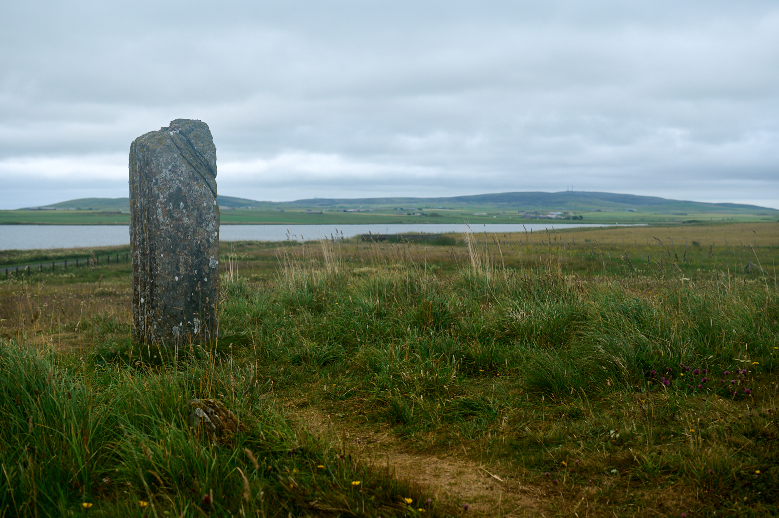
View towards the other side of Loch Harray.
And looking back towards the Ring of Brodgar, all across the meadow.
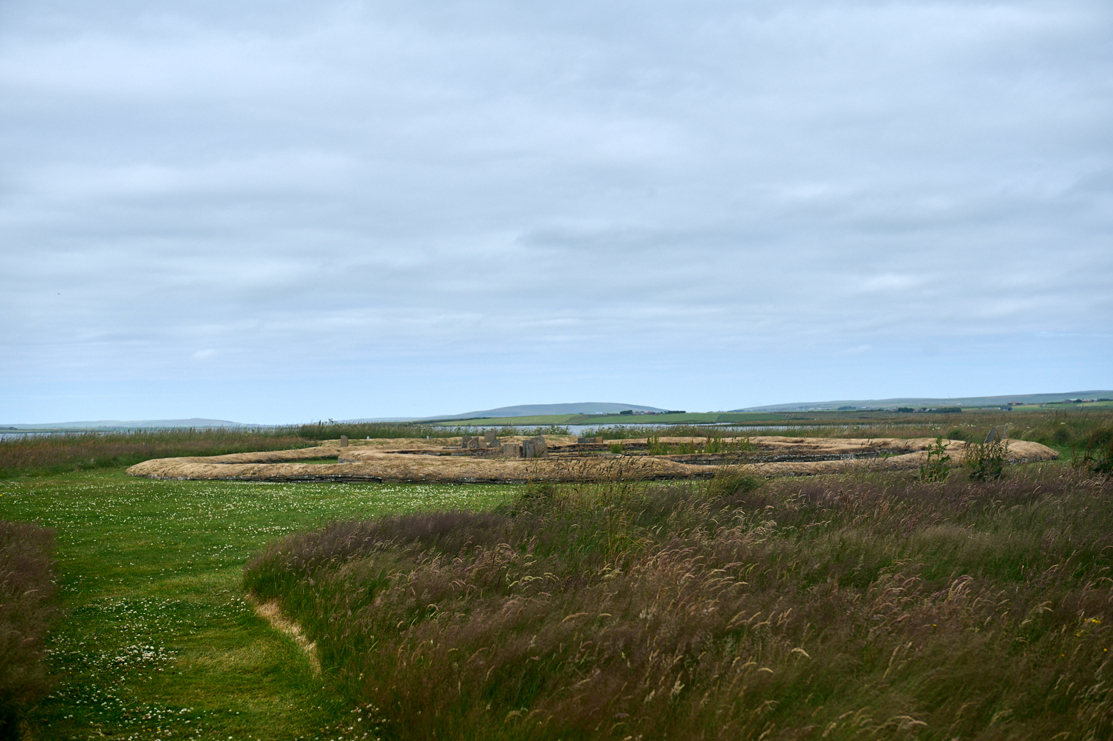
Ness of brodgar
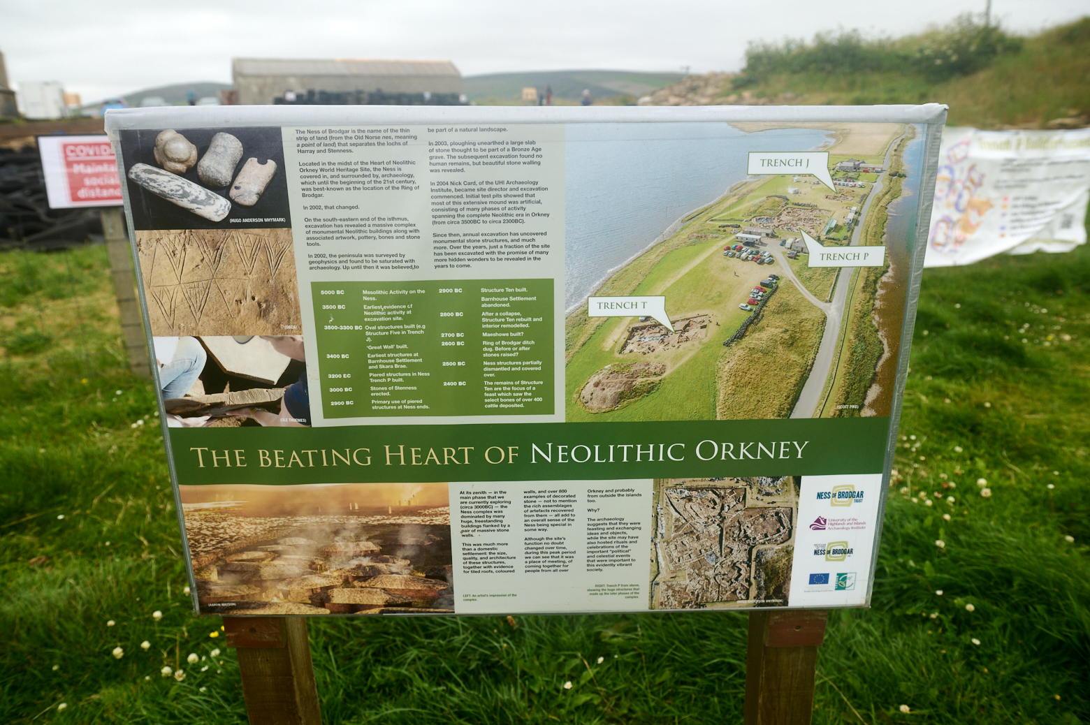
The Ness of Brodgar is a thin strip of land between the lochs of Harray and Stenness.
The Ness is covered in, and surrounded by, archaeology. Until the beginning of this century, it was best known as the site of the Ring of Brodgar and the nearby Standing Stones of Stenness, both part of the Heart of Neolithic Orkney World Heritage Site. In 2002 all that changed when a geophysical survey revealed a huge prehistoric complex, indicating many buildings beneath the Ness. The dense concentration of structures astonished the worldwide archaeological community. (orkney.com)
In 2003 the owners of one of the nearby houses on the Ness of Brodgar wanted to prepare a field for a wildflower meadow.
The ploughman uncovered what looked like the slab of a Bronze Age burial kist, and on inspection, a vast complex of buildings dating as far back as 3300 BC were discovered. (Northlinkferries.com)
Every summer it is possible to see archaeologists at work at the Ness, revealing a large complex of monumental Neolithic buildings along with decorated masonry, pottery, stone tools, evidence of stone tiled roofing and much more. 2021 a small group was back at work and parts of the excavations were open to taking a peek inside.
So far a number of buildings, some of them on top of each other have been excavated and all the finds are changing the knowledge about the Neolithic time.
Signs on the site are telling us about the finds and about the history of the place. The Information Panels.
The site was surrounded by a vast boundary wall, sometimes referred to as the Great Wall of Brodgar, wider than Hadrian’s Wall.
Why the Ness of Brodgar was abandoned is unknown. Perhaps a new religion took over or a new power ruled over the islands. However in 2200 BC the Ness of Brodgar was robbed of stone, and then somehow, this vast complex of buildings became lost, covered by dirt and plants, and forgotten in the landscape. (Northlinkferries.com)
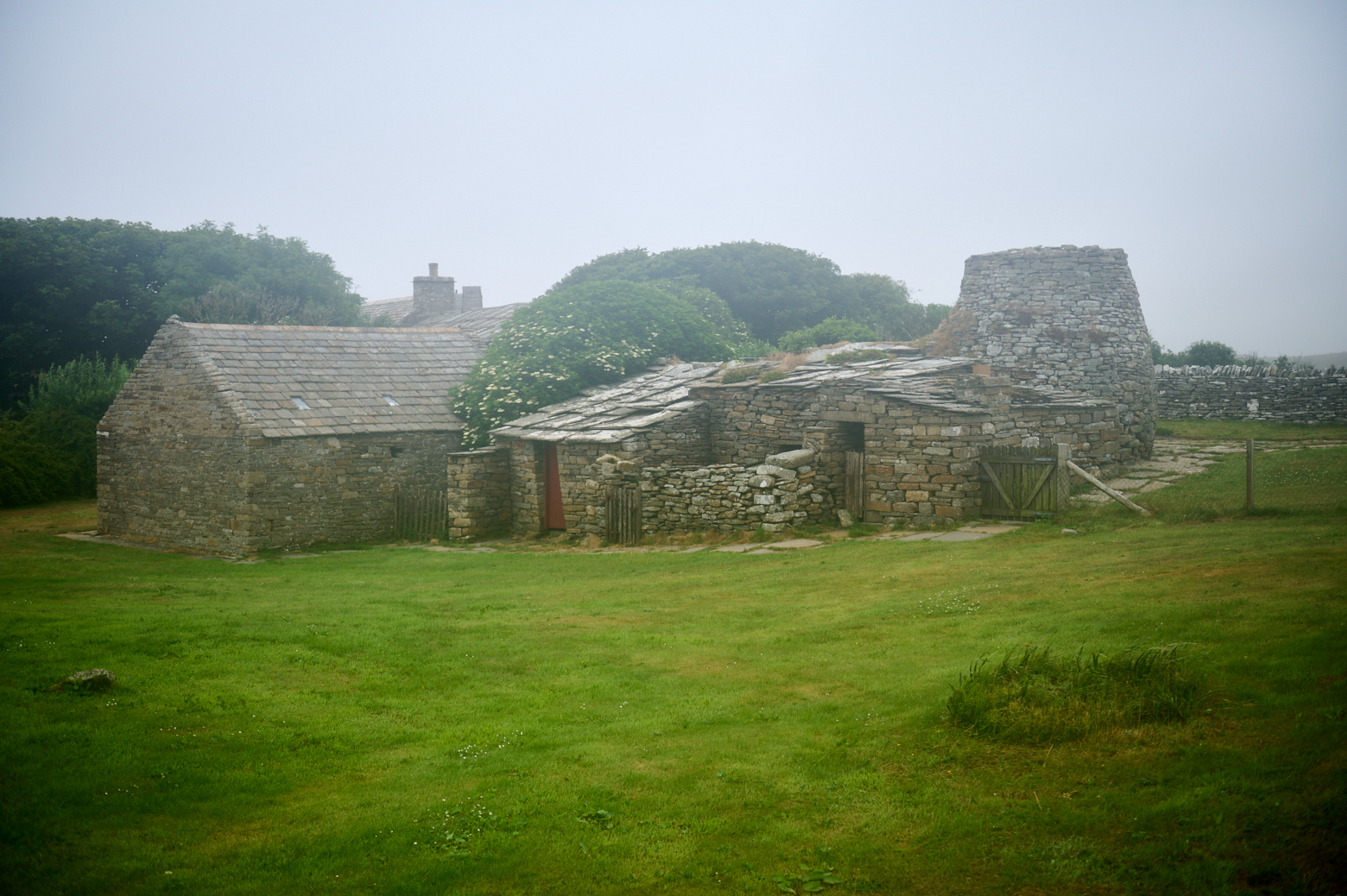
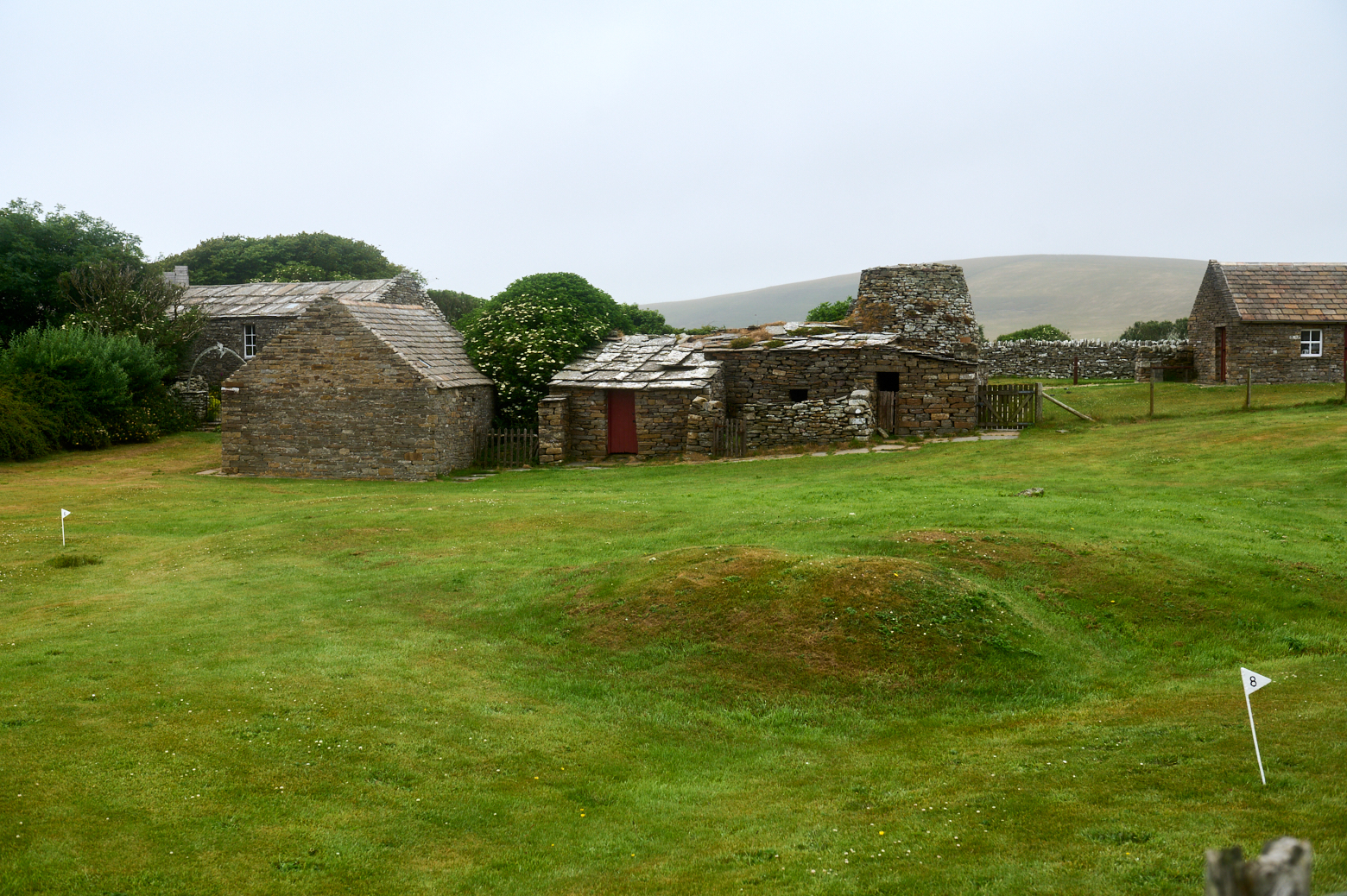
On my way back to may little cottage near Skaill I stopped at the Kirkbuster Museum, which was unfortunately closed that day, so I could only take a peek from the outside onto the last “firehoose” in Northern Europe.
The house has a central hearth, complete with peat fire, and a stone neuk bed reminiscent of the Neolithic interiors that can be seen at sites such as Skara Brae, Orkney. Kirbuster was occupied up until the 1960s (Orkney.gov.uk)
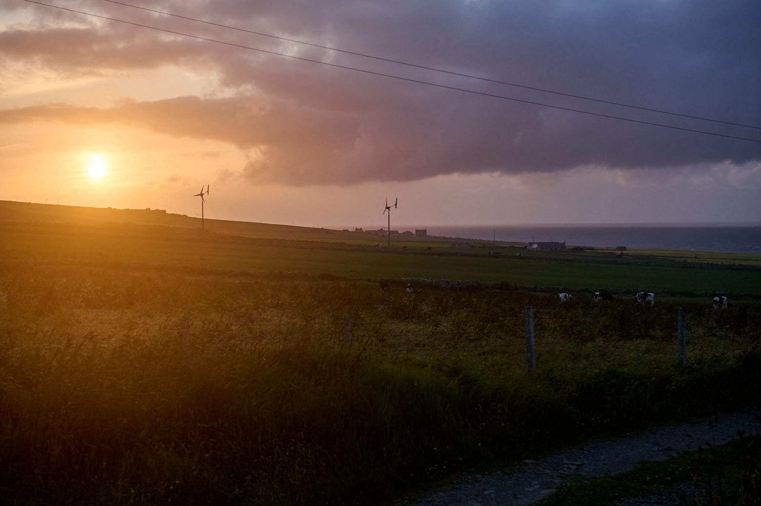
My last evening in Evie and the first almost sunset I saw in the last weeks, it really doesn´t get dark in the summer in Shetland or Orkney.
The next day I went back to the Ness of Brodgar, the Neolithic Heart of Orkney, but went to the other side of Loch of Harray first to enjoy the views over the landslip from there.
View towards the Ring of Brodgar and the Ness of Brodgar.
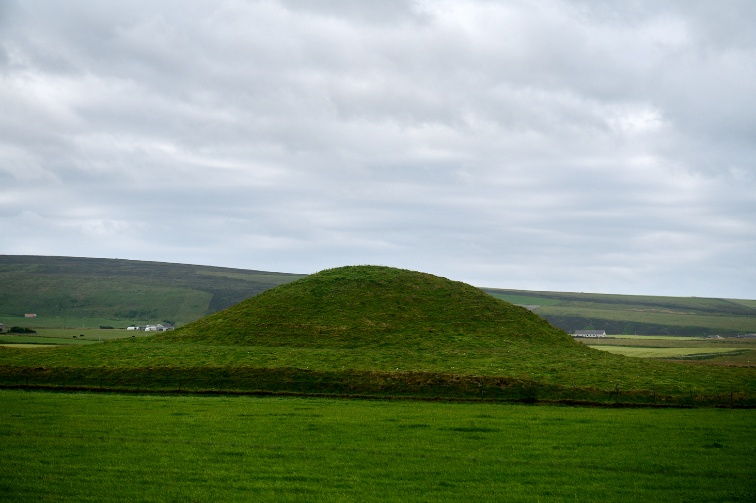
The backside of Maeshow – the large Neolithic chambered tomb that was still closed because of Covid safety measurements, but the Historic Environment Scotland offered talks about and so I learned quite a lot of the history of the tomb and Neolithic Orkney.
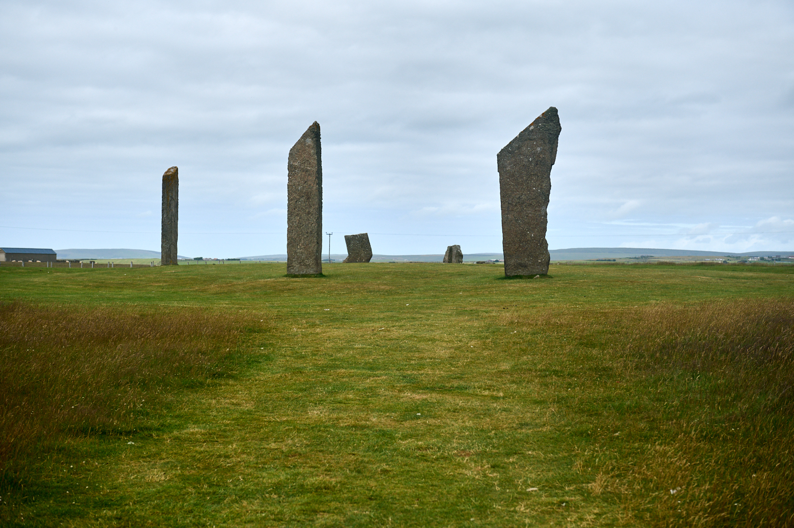
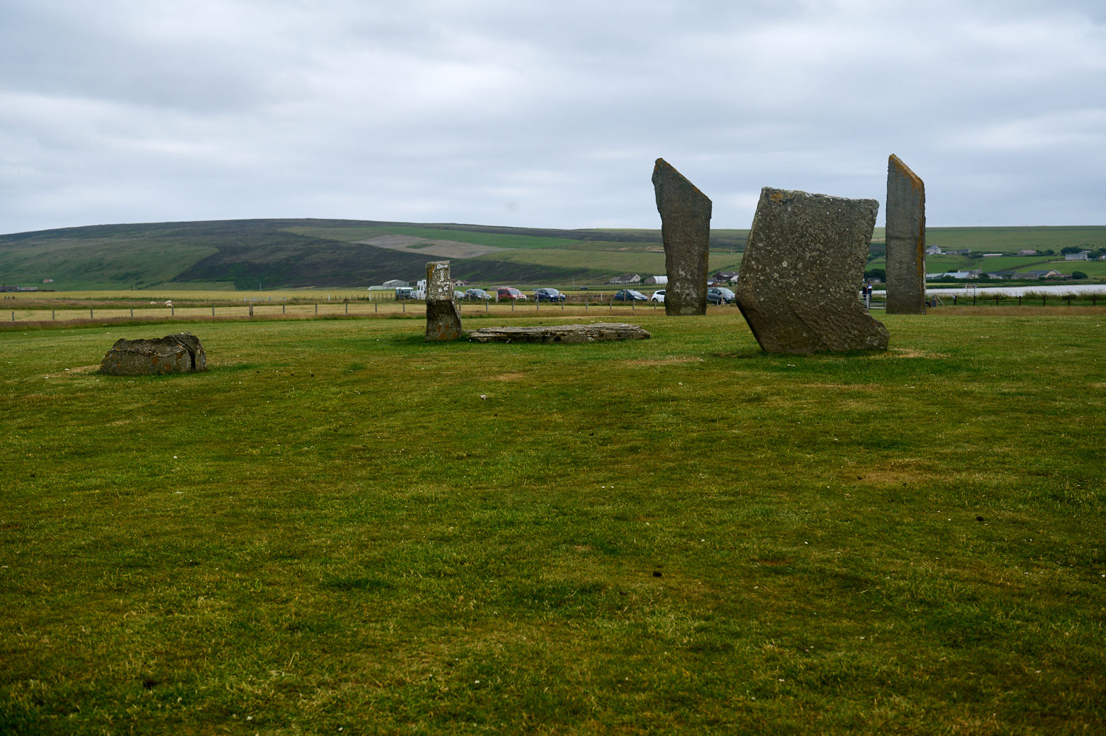
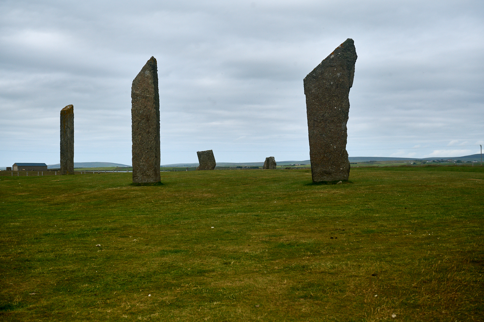
Stones of STenness
When driving back towards the Ness of Brodgar one can´t miss the Stones of Stenness Circle and Henge – another impressive circle of standing stones and also the ruins of a settlement.
The Stones of Stenness you see and marvel at today are just a part of a ring of 12 tall stones and a surrounding ditch placed here some time between 3000BC and 2500BC. This was about the same time that nearby Maeshowe was being built, but well after Skara Brae was occupied and well before another stone circle was constructed a little to the north at the Ring of Brodgar. (Undiscovered Scotland)
The site dates back to at least 3100 BC and is one of the earliest stone circles in Britain.
View towards the Ness of Brodgar and Ring of Brodgar
Time hasn´t treated the stones well, in the 19th century only 4 stones were still standing and a local farmer got annoyed with all the visitors and
He destroyed the nearby “Stone of Odin” and toppled a second stone that was part of the ring before he was stopped. The Stone of Odin was an especially sad loss. It had a circular hole, through which local lovers plighted their troth by holding hands. (Undiscovered Scotland)
Around 1900 this toppled stone was reerected and was another one found under the turf.
When complete, the Stones of Stenness would have been a magnificent sight. The tallest of the stones still standing is 5.7m or 19ft high. Imagine the impact of three times as many of them. (Undiscovered Scotland)
The views all around the circle are amazing, on clear days one sees up until the Island of Hoy.
View stowards Maeshow tomb.
The Stones of Stenness today consist of four upright stones up to 6m in height in a circle that originally held 12 stones. The focus of the interior was a large hearth. The stones were encircled by a large ditch and bank, the form of which has been lost over time by ploughing. (Historic Enviroment Scotland)
It might have never been completed though, excavations showed that the last two stones might have never been erected.
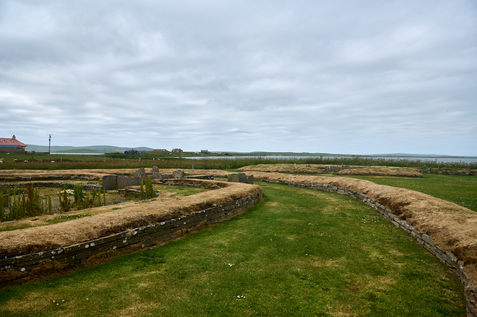
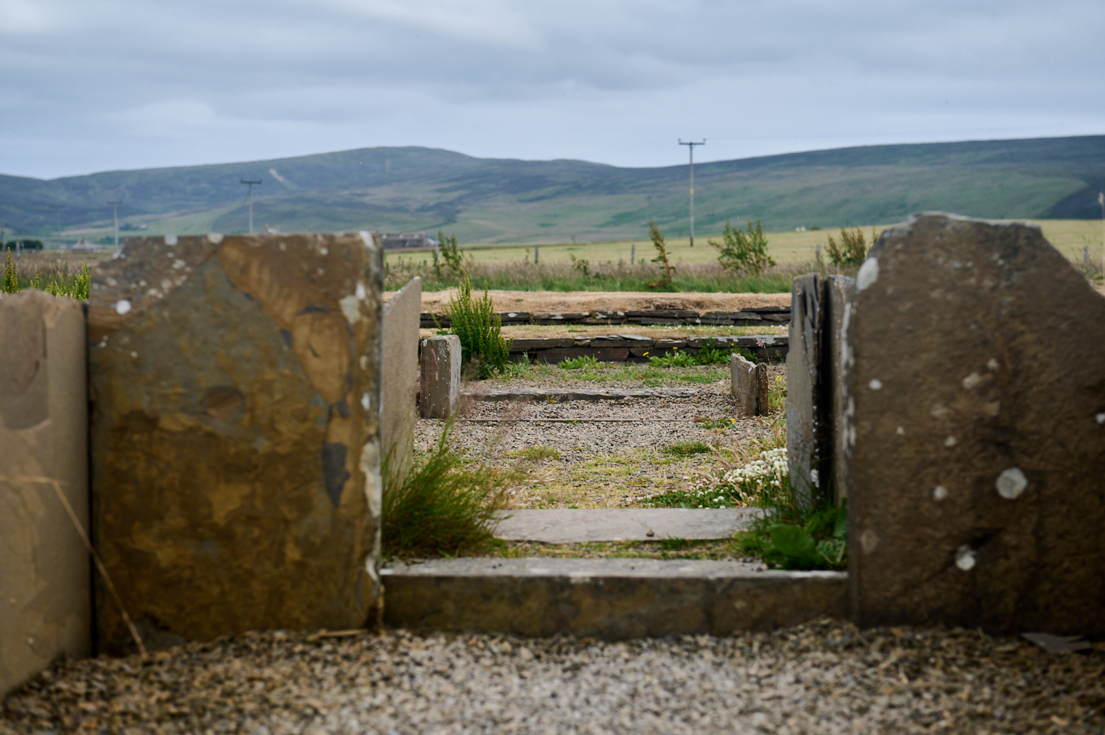
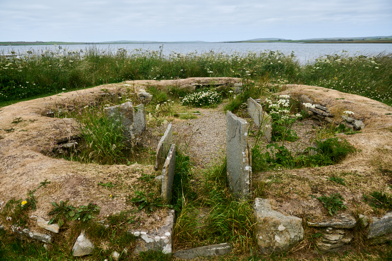
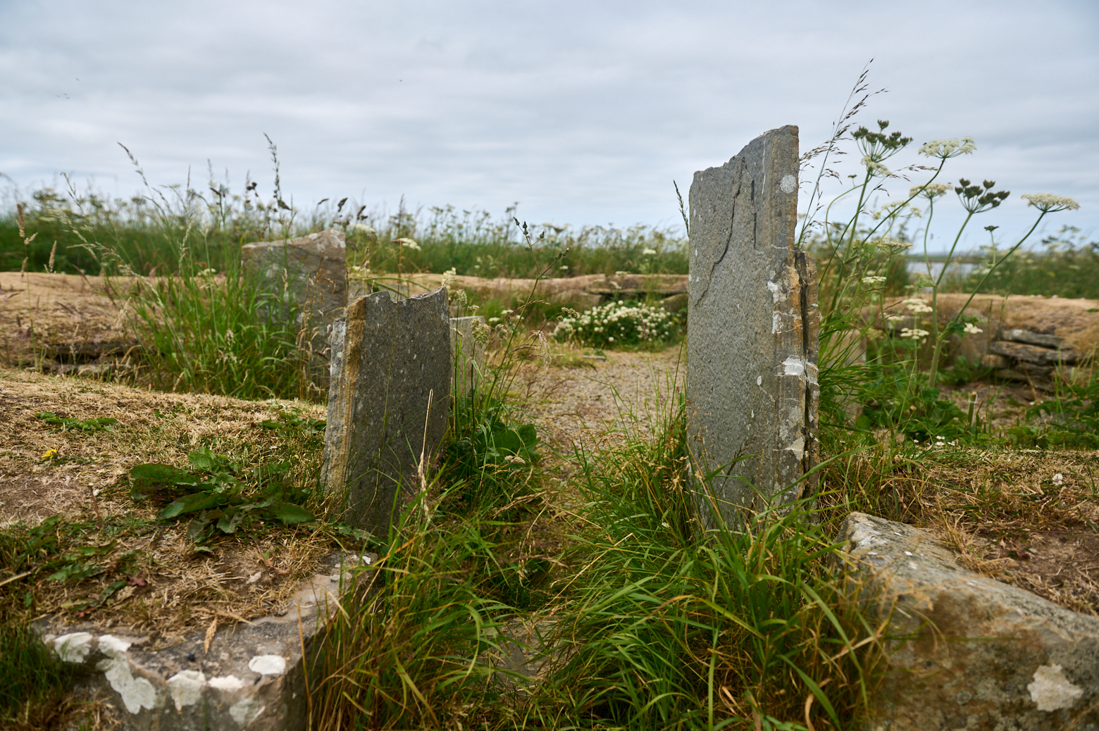
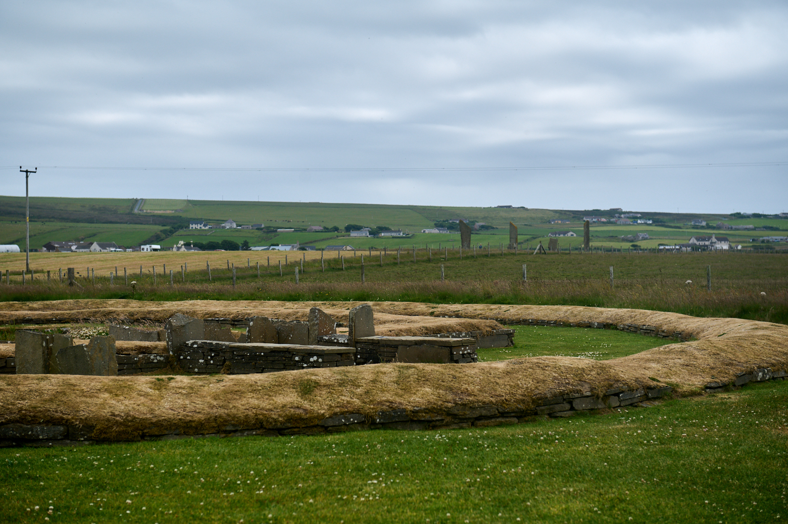
The Barnhouse settlement
Follow the path toward the loch behind the stone circle and you will find the remains of another Neolithic settlement – the Barnhouse settlement.
The Barnhouse settlement was inhabited between 3300 and 2600 BC and consisted of six small houses similar in style to the early circular houses at Skara Brae built around a larger and more elaborate building. A stone age village.
First excavated in 1984 this settlement is often overlooked and less known than its counterpart in Skaill bay.
Unlike Skara Brae, which was protected for millennia by a cocoon of sand, Barnhouse had been badly damaged by centuries of ploughing. As a result, only the reconstructed lower courses of the structures are visible today. (Ness Of Brodgar. co.uk)
It might have been the home to the stonemasons of the Ring of Stenness or it even might have been the home of people of great importance according to the size of the houses.
The finding of this village completely changed the view of the Ness of Brodgar.
Before its discovery, the area around the Ness of Brodgar peninsula was seen as a purely “ritual landscape” – the home of Neolithic monuments, megaliths and stone circles kept separate from “domestic” life.
The settlement at Barnhouse showed, without a shadow of a doubt, that people were dwelling among the monuments. (Ness of Brodgar.co.uk)
The short distance between the circle of standing stones and the settlement.
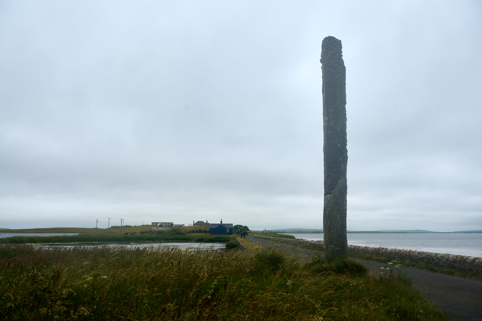
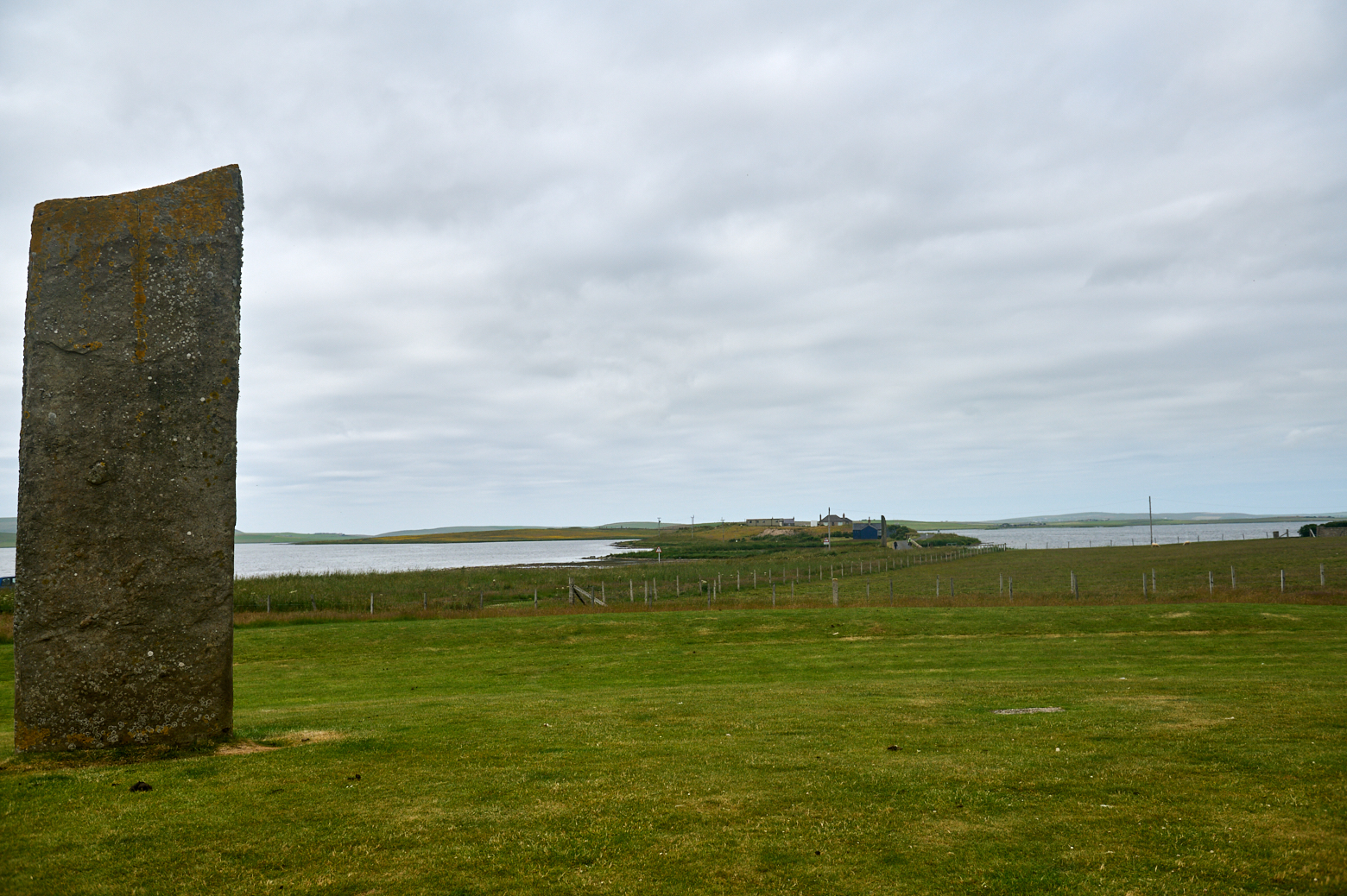
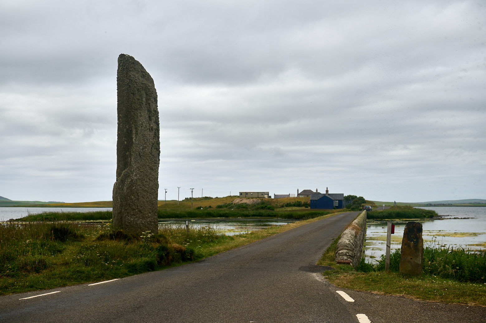
The Watch Stones
Heading back to the roading towards the Ness of Brodgar one can´t miss the 6,5m tall standing stone in front of Brig o’ Brodgar (bridge)
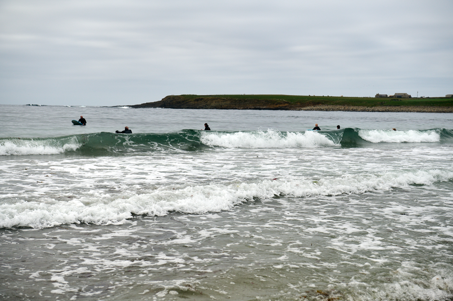
Skaill Bay
I was heading back to Skaill beach, close to my new home for the next days and enjoyed some time watching the surfers and just relaxing.