Tag: road trip

  • CLICKIMIN BROCH

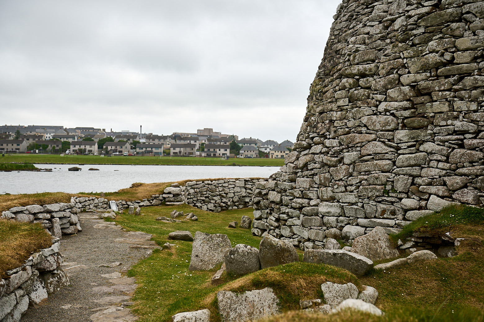
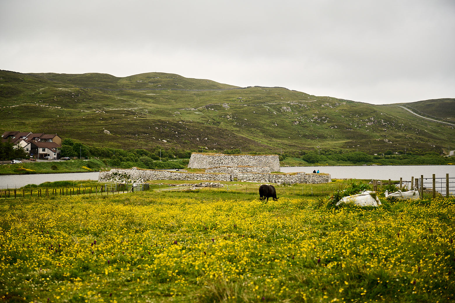
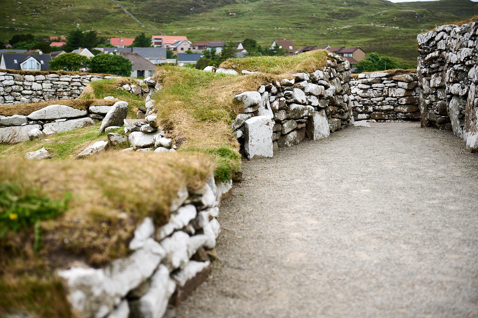
    Saturday morning I met my lovely hosts for a breakfast in Lerwick and afterwards I just crossed the supermarket parking space to get to Clickimin Broch situated in a little loch in Lerwick.
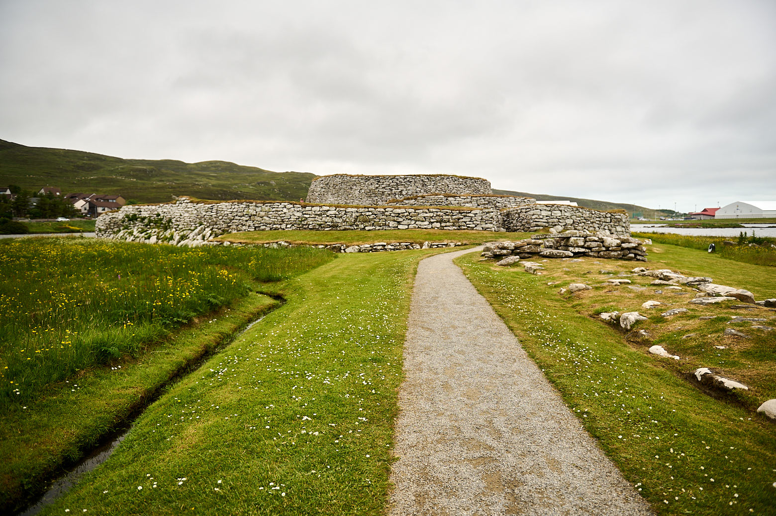
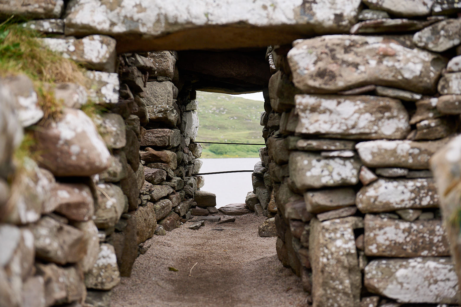
    Broch” is Scottish and means “fort“. They are defensive structures from the Iron Age and are round tall buildings with a spiral staircase running between the inner and outer walls.

    There is a school on the other side of the Loch of Clickiminand my hosts told me that they saw the students walking around the loch as exercise when the school gymnasium was closed because of Covid.

    Clickimin Broch in Lerwick, Shetland.

    About 3000 years ago, during the Bronze Age,

    a family built a small farmhouse on a grassy islet surrounded by loch or marsh, and they walled the islet to enclose their cattle and sheep. (Undiscovered Scotland)

    The remains of the farmhouse lie on the northwest side of the main broch. Back then the water levels were higher and a narrow causeway connected the islet with the mainland.

    Clickimin Broch in Lerwick, Shetland.

    Around 200 BC a stronger wall was built around the islet and a ditch was dug to separate the land from the farm and could only be crossed via a draw-bridge.

    The farm continued to be the main residence, but other wooden buildings with thatched roofs were built within the defensive wall. Around this time the Loch of Clickimin was cut off from the sea and ceased to be tidal. (Undiscovered Scotland)

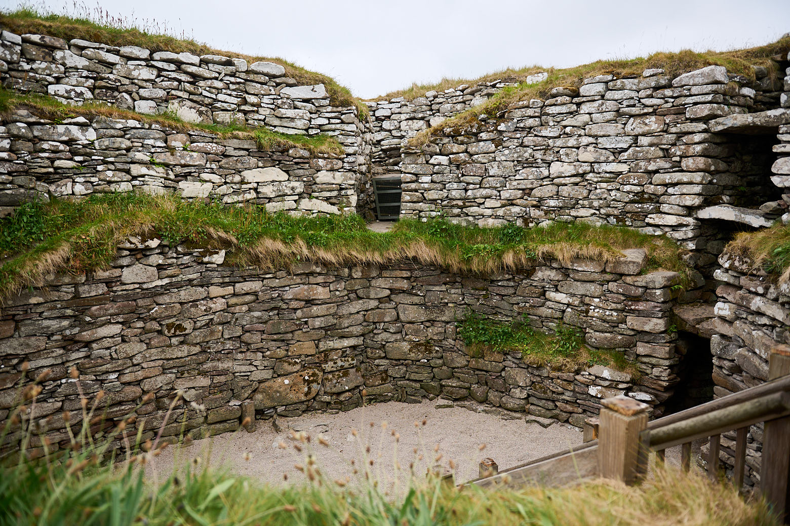
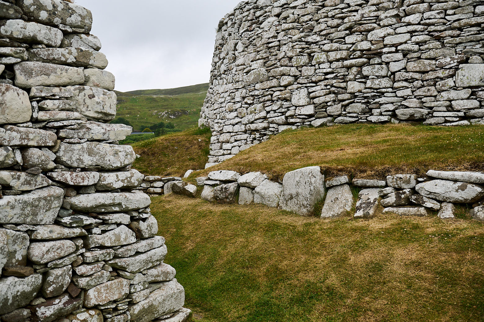
    A century later a “blockhouse” was built inside the defensive walls but never finished. Soon the works on the broch started. The entrance to the broch is behind the blockhouse, which is unusual for these buildings.

    Clickimin Broch in Lerwick, Shetland.

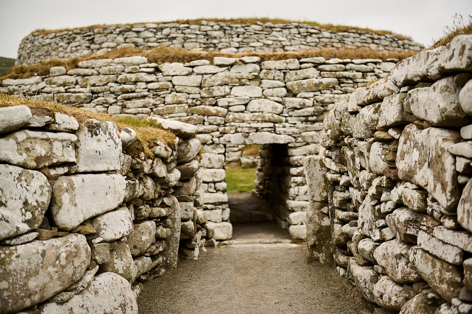
    Originally the broch was about 12-15m high and had several rooms, enclosures and stairs within the thick, dry stone walls. There were also internal wooden structures providing shelter and accommodation for a significant number of people.

    Later it was reduced in its size (and height) and became the home of one single family.

    Clickimin Broch in Lerwick, Shetland.

    From around AD500, occupation became less organised and the houses in use were poorly built and partly dug into the ruins of the earlier structures. By the time the Norse arrived in the 800s, Clickimin had been abandoned and forgotten. (Undiscovered Scotland)

    Clickimin Broch in Lerwick, Shetland.

    In the 1850ies the Victorian curiosity leads to quite crude digging up the mound and “restoring” of their findings. In the 1950s the area was professionally excavated and today Historic Environment of Scotland cares for Clickimin Broch.

    Clickimin Broch in Lerwick, Shetland.

    Clickimin Broch in Lerwick, Shetland. Clickimin Broch in Lerwick, Shetland.


  • St. Ninian´s

    On my way home from Jarlshof I made one further stop – at St. Ninian´s Isle. St. Ninian´s Isle is a small tidal island on the south-western coast of Shetland and connected to mainland Shetland with a “tombolo”.

    Looking over to St. Ninians Isle in Shetland.

    A tombolo is a narrow piece of sand connecting an island to the mainland – the tombolo or locally known as “ayre” connecting St. Ninian´s Isle to mainland Shetland is the biggest one in the UK.

    The causeway is usually covered by the sea in the wintertime with waves crashing over it and “returns” in spring to let walkers cross it to the island.

    Looking over to St. Ninians Isle in Shetland.
    View from St. Ninian´s Isle towards the mainland.

    A small chapel from the 12th century or better said the ruins of a small chapel dedicated to Shetland’s patron saint, St. Ninian of Galloway can be found at the end of the causeway, but somehow I missed it. I walked to the isle and up a bit, but decided to return another time for the circular walk as it was already late in the day.

    Looking over to St. Ninians Isle in Shetland.

    But under the chapel, there were already older buildings, Neolithic graves have been found under the (former) floor of the chapel.

    In 1958, an excavation found a hoard of 8th century silver in the chapel grounds under a stone slab in a wooden box, which caused a renewed archaeological interest in the island. (St. Ninian´s Isle)

    28 Pictish silver objects and the jaw bone of a porpoise were buried under a cross-marked slab close to the altar. It might have been buried there to hide it or stolen from a Viking raid. The remains of a pre-Norse chapel were also found.

    Looking over to St. Ninians Isle in Shetland.

    Shetland was formed after the glacial times,

    Spits, bars and ayres or tombolos are characteristic of the inner coast and voes of Shetland. They are typical of submerging coastlines. Today in Shetland you are never more than 5km from the sea but it wasn’t always like this. During glacial times, a large amount of water was locked away as ice, making sea levels considerably lower. Only when the ice began to melt some 12,000 years ago did the seas begin to rise. (Shetland Heritage)

    Much of Shetland was flooded as the lower ends drowned in the sea and the many sea inlets,  the ‘voes’ now so characteristic for Shetland, were formed. It was also the rising sea levels that formed the causeways and stunning sandy beaches.

    Looking over to St. Ninians Isle in Shetland.

    It doesn´t get dark in Shetland in the summer, it was late evening already and after a short break on this bench, it was time to go home for the day.


  • West Voe Beach

    West Voe beach near Sumburgh Shetland in Scotland, white sands and turquoise water.

    The beaches in Scotland will never cease to amaze me – white sand and crystal clear turquoise water.

    West Voe beach near Sumburgh Shetland in Scotland, white sands and turquoise water.

    I just had to walk or better-said drive around the corner from Jarlshof to West Voe beach. On the left side of the photo, you see the lighthouse at Sumburgh Head in the back and just endless waves straight ahead.

    West Voe beach near Sumburgh Shetland in Scotland, white sands and turquoise water.

    It is a stunning beach and offers a beautiful walk but one has to say it is not the quietest one. At least not while I was there. West Voe beach is right next to Shetland´s airport and helicopters were flying in and out.

    West Voe beach near Sumburgh Shetland in Scotland, white sands and turquoise water.

    It might look like a Caribbean beach but probably felt a bit colder, the water was really nice though!

    West Voe beach near Sumburgh Shetland in Scotland, white sands and turquoise water.